
Impacts & compensatory measures
Environmental impacts
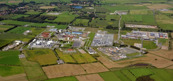
Since cavern construction began at Etzel in 1971, a very shallow depression, invisible to the naked eye, has formed over the cavern field as an effect of mining activities, leveling off toward the edges to such an extent that no measurable effects are detected there.
At the 19th meeting of the STORAG ETZEL cavern advisory council in November 2016, the results of the final report of the Federal Institute for Geosciences and Natural Resources (BGR) on the new subsidence forecast for the Etzel cavern field, which is now available, were presented.
The BGR had already presented preliminary results of the subsidence forecast for the Etzel cavern field in April 2016. A final review based on current findings resulted in minor changes to the preliminary values.
According to this, a maximum subsidence of now 2.55 meters is to be expected in the center of the subsidence depression at the end of cavern operation in 2120. This lowest point is located approximately in the center in the area of the cavern field itself.
Towards the edge of the depression, over a distance of about five kilometers, the subsidence amounts decrease rapidly. The calculations are based on the permitted framework of 99 caverns and assumed 100 years of operation for the Etzel cavern site.
In 2018, 75 caverns are in operation at the site, and two new construction caverns were last completed in the first quarter of 2017. After the end of operations in 2117, when the caverns are filled for storage, subsidence will come to a virtual standstill.

In the course of another 200 years after the end of operations, the experts assume only an insignificant subsidence of 2 cm of the ground to 2.57 meters in the year 2317 (see figure).
Beyond the course of the expected ground subsidence, the specialists of the BGR have also given further movement variables as a basis for the investigation of the possible effects on the protected assets around the cavern field. On the basis of the confirmed actual data, the forecast concludes that the slowly occurring ground subsidence will also cause tilting.
During the assumed operating time of 100 years, i.e. until the year 2120, these inclinations at the surface will reach a maximum value of 1.33 millimeters per meter. In the course of the subsequent cavern storage, the inclinations will hardly increase measurably and will not exceed 1.34 millimeters per meter until the year 2317. Experience shows that such magnitudes do not cause damage to buildings or infrastructure. Nevertheless, STORAG ETZEL conducts continuous building monitoring to preserve evidence.
The Federal Institute for Geosciences and Natural Resources based in Hanover was commissioned to carry out the subsidence prognosis. Similar investigations had already been carried out by the BGR in 2009/10 and 2012. The 2016 subsidence forecast is the key basis and prerequisite for the so-called impact analysis. This has been available since 2018 and deals with the concrete consequences of subsidence on surface and groundwater, buildings, infrastructure and other protected assets as well as the possible control and compensation measures.
Background
The subsidence forecast is based on scientific modeling of the subsidence processes at the Etzel site. The location, extent and depth of the subsidence depression at a cavern storage facility depends, among other things, on various geometric and technical parameters, such as the number and spatial distribution of the caverns, depth location, cavern volume, and, in particular, operating history, measured convergence and measured subsidence at the surface. They are all included in the complex calculation model of the BGR.
This model of the subsidence forecast for the Etzel site is calibrated against the measurement results from over 40 years of altitude monitoring, i.e. it is checked for correctness for the current ACTUAL state (2015) by recalculating the historical subsidence course. The most recent elevation survey (leveling) conducted in 2016 in the vicinity of the Etzel cavern facility showed a maximum subsidence (1974 - 2016) of 44 cm in the center of the trough. Based on certain general conditions for the future cavern operation (99 caverns / 100 years), the subsidence course at the surface and the ground movement elements were calculated for the future. The present subsidence prediction is to be validated by future elevation measurements, i.e. checked for validity, by regularly comparing the predicted subsidence course with the measurement results of the leveling.

Environmental Impact Preliminary Assessments
Information on preliminary environmental impact assessments for STORAG ETZEL construction measures can be found on the website of the State Office for Mining, Energy and Geology (LBEG).

Compensatory measures
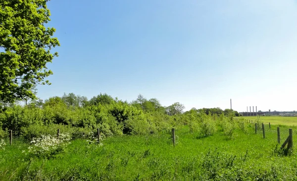
Since the beginning of 2010, nature conservation compensation and replacement measures have been implemented at the Etzel site on behalf of STORAG ETZEL due to the expansion of operational areas. In spring 2012, areas totaling around 60 hectares were approved for this purpose by the Lower Nature Conservation Authority of the Wittmund district.
The concrete implementation took place, for example, through local planting of locally typical woody plants or, on a large scale, through the abandonment of intensive agricultural cultivation of original arable and grassland areas and their conversion into extensive grassland.